View the series
View the series
Only available for non-commercial distribution
© CNRS / BnF - 2019
Reference
6879
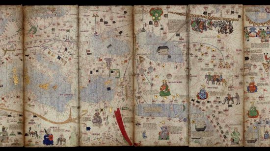
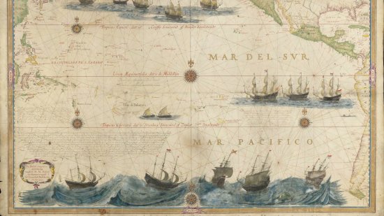
Map of the East Indies, from the Cape of Good Hope to Japan by Pieter Goos, 1700
Series title
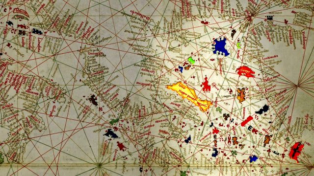
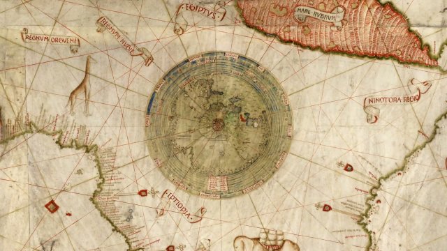
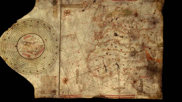
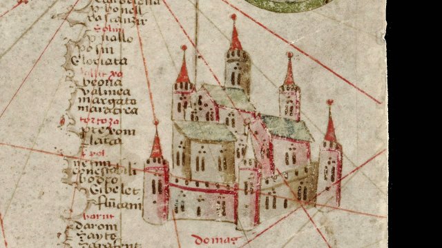
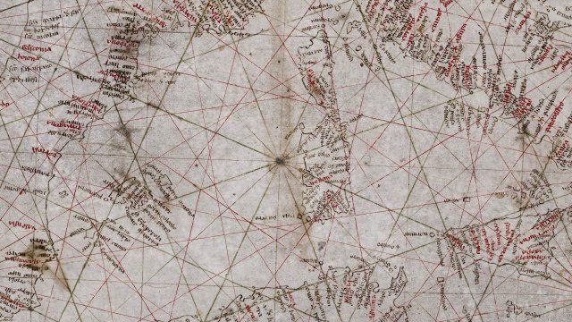
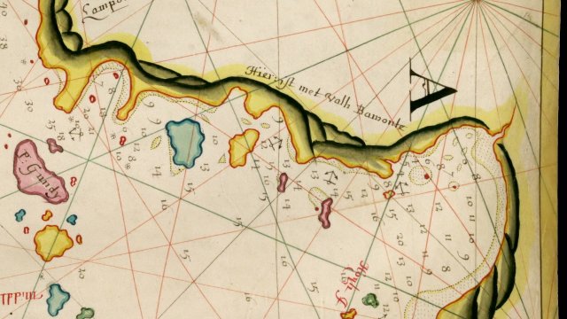
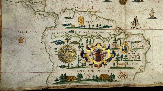
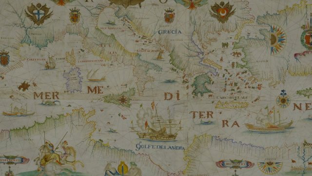
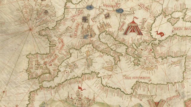
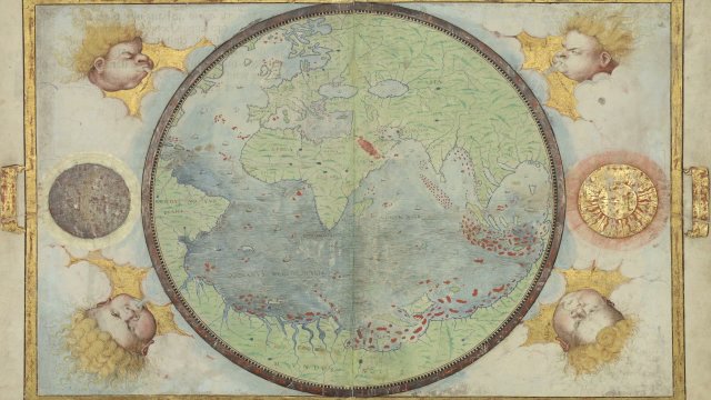
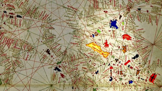
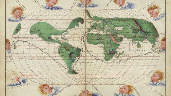
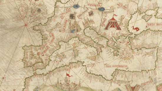
At the Heat of the MapsThis nautical chart of the Indian Ocean covers the entire expanse of the Dutch East India Company's operations from the Cape of Good Hope to Japan. It was engraved on copper and printed on vellum in Amsterdam by Pieter Goos (1616-1675) in 1660, then republished in 1700 by Johannes Van Keulen. This portolan depicted the state of Dutch knowledge about the Indian Ocean and the southwest Pacific in 1644 after the exploratory sailing of the Dutchman Abel Tasman along the coast of Australia. A unique feature is that it is possible to make out several pencil-drawn routes on the map, proving that it was used when navigating at sea.
A map kept at the French national library BnF (Bibliothèque nationale de France), Maps and Plans Department, shelf mark number Ge SH 18 PF 213 DIV 3 P 12 RES
View this document in the digital Gallica library:
https://gallica.bnf.fr/ark:/12148/btv1b59057812
Duration
00:05:28
Production year
Définition
HD
Color
Color
Sound
Sound
Version(s)
French
Original material
HD
Add to my selection
Terms of use
The use of media visible on the CNRS Images Platform can be granted on request. Any reproduction or representation is forbidden without prior authorization from CNRS Images (except for resources under Creative Commons license).
No modification of an image may be made without the prior consent of CNRS Images.
No use of an image for advertising purposes or distribution to a third party may be made without the prior agreement of CNRS Images.
For more information, please consult our general conditions