View the series
View the series
Only available for non-commercial distribution
© CNRS / BnF - 2019
Reference
6866
Nautical Atlas of the World, aka Atlas Miller by Lopo Homen, Pedro Reinel, Jorge Reinel and Antonio de Holanda, 1519
Series title
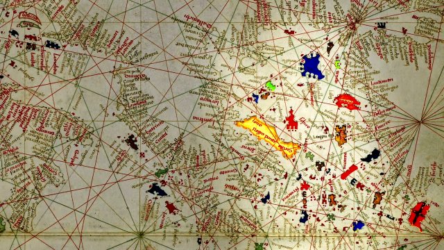
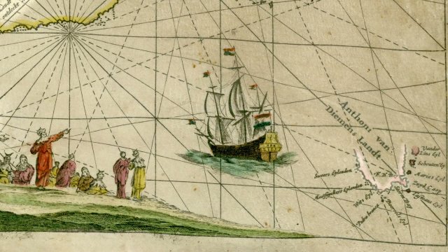
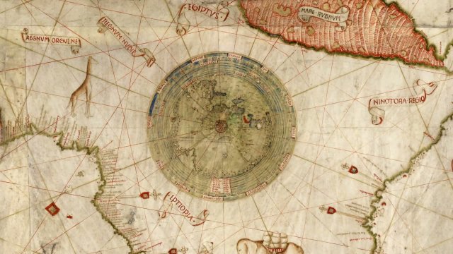
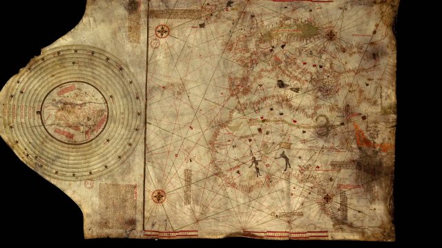
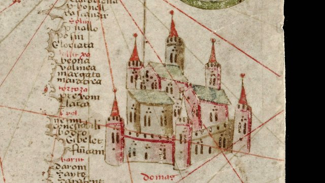
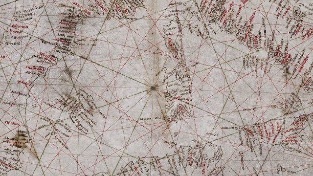
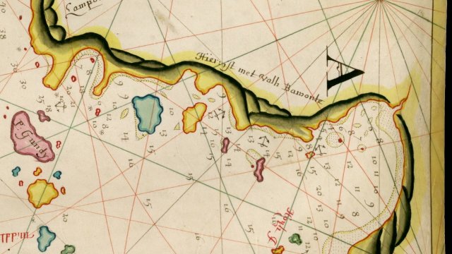
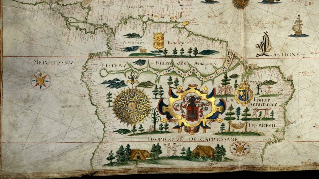
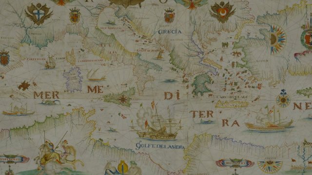
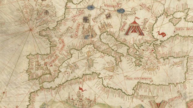
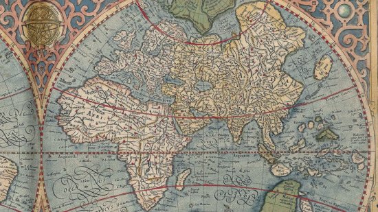
At the Heat of the MapsThe Miller Atlas, named after its former owner, is a collection of nautical charts completed in 1519. Commissioned by the King of Portugal Manuel I, it is a masterpiece of Portuguese cartography resulting from the collaboration of several cartographers and artists: Lopo Homem, Pedro Reinel, Jorge Reinel and the illuminator Antonio de Holanda. It was intended to show the power and expanse of the Portuguese Empire, which extended from Brazil to Indonesia. This portolan opens onto a world map centred on the Portuguese hemisphere as delimited in 1494 by the Treaty of Tordesillas. The subsequent regional maps cover the entire known world at the time, except for Africa, the map of which went missing.
A map kept at the French national library BnF (Bibliothèque nationale de France), Maps and Plans Department, shelf mark numbers GE D-26179 (RES), GE DD-683 (2-5 RES), GE AA-640 (RES)
View this document in the digital Gallica library:
World map: https://gallica.bnf.fr/ark:/12148/btv1b55002620g
Europe and Azores: https://gallica.bnf.fr/ark:/12148/btv1b55002604f
Indian Ocean, Madagascar and Insulindia: https://gallica.bnf.fr/ark:/12148/btv1b55002605w
Magnus sinus and Moluccas: https://gallica.bnf.fr/ark:/12148/btv1b55002606b
Brazil: https://gallica.bnf.fr/ark:/12148/btv1b55002607s
Duration
00:04:11
Production year
Définition
HD
Color
Color
Sound
Sound
Version(s)
French
Original material
HD
Add to my selection
Terms of use
The use of media visible on the CNRS Images Platform can be granted on request. Any reproduction or representation is forbidden without prior authorization from CNRS Images (except for resources under Creative Commons license).
No modification of an image may be made without the prior consent of CNRS Images.
No use of an image for advertising purposes or distribution to a third party may be made without the prior agreement of CNRS Images.
For more information, please consult our general conditions