View the series
View the series
Only available for non-commercial distribution
© CNRS / BnF - 2019
Reference
6873
Pisana Carta, Anonymous - 13th century (The)
Series title
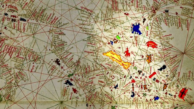
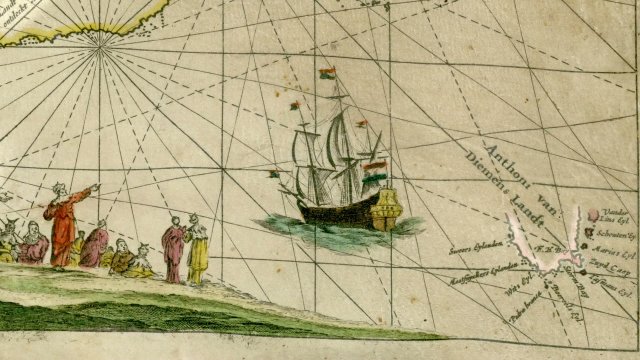
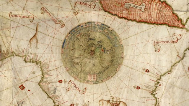
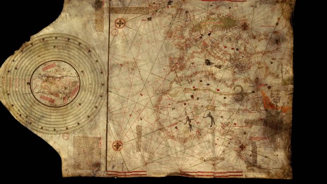
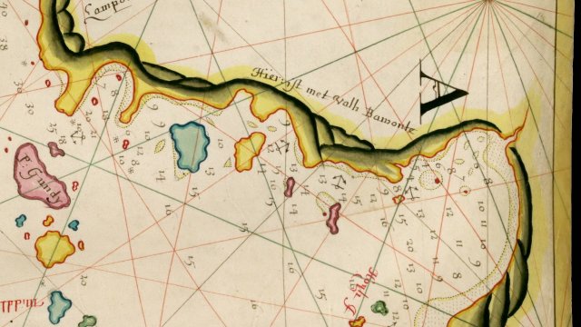
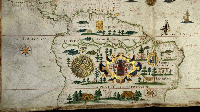
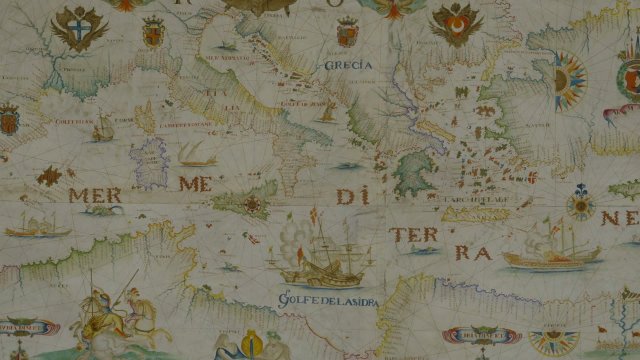
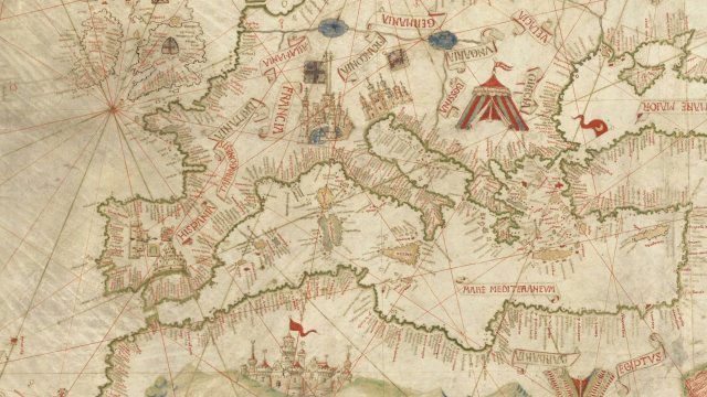
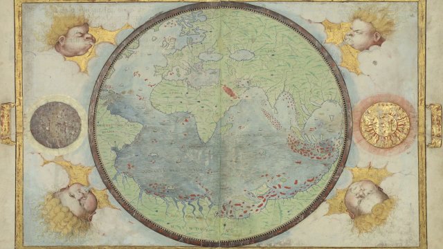
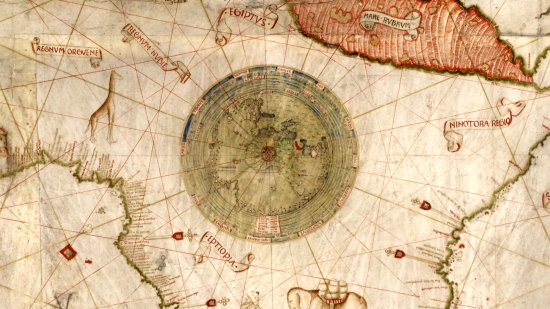
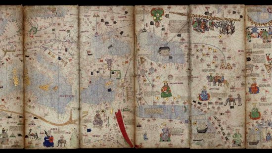
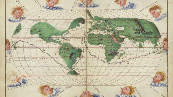
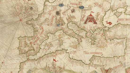
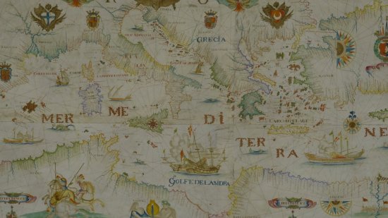
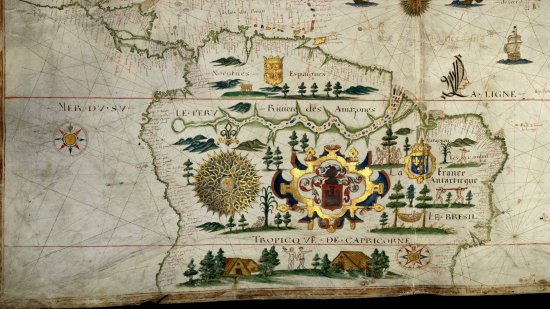
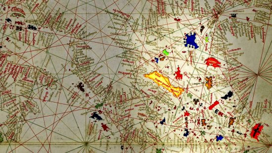
At the Heat of the MapsDated from the late13th century, the so-called "Pisana Carta” is considered to be the oldest nautical chart that has ever come down to us. It mainly covers the Mediterranean Sea, of which the Spanish and French coasts and the large islands are represented with some degree of accuracy. This map is part of the charts called "portolans” and it comprises their main attributes: harbour and port names inscribed perpendicular to the coastline, wind lines indicating compass directions and distance scales. Appearing in the ports of the western Mediterranean, these nautical charts turned out as key to naval mastery and the dissemination of the outcomes of European explorations from the 15th century onwards.
A map kept at the French national library BnF (Bibliothèque nationale de France), Maps and Plans Department, shelf mark number Ge B 1118 RES
View this document in the digital Gallica library:
https://gallica.bnf.fr/ark:/12148/btv1b52503226n
Duration
00:03:52
Production year
Définition
HD
Color
Color
Sound
Sound
Version(s)
French
Original material
HD
Add to my selection
Terms of use
The use of media visible on the CNRS Images Platform can be granted on request. Any reproduction or representation is forbidden without prior authorization from CNRS Images (except for resources under Creative Commons license).
No modification of an image may be made without the prior consent of CNRS Images.
No use of an image for advertising purposes or distribution to a third party may be made without the prior agreement of CNRS Images.
For more information, please consult our general conditions