View the series
View the series
Only available for non-commercial distribution
© CNRS / BnF - 2019
Reference
6870
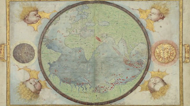
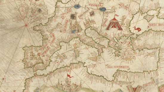
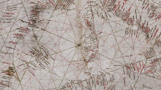
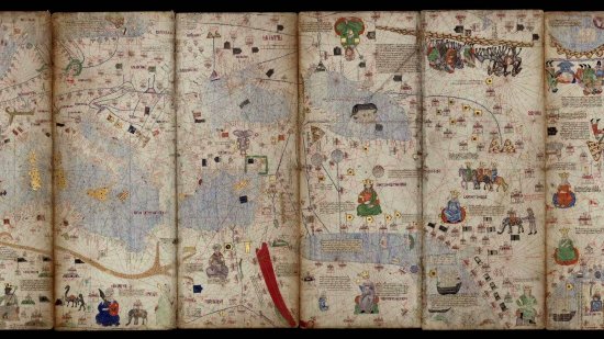
Map of the Atlantic Ocean by François Ollive, 1662
Series title
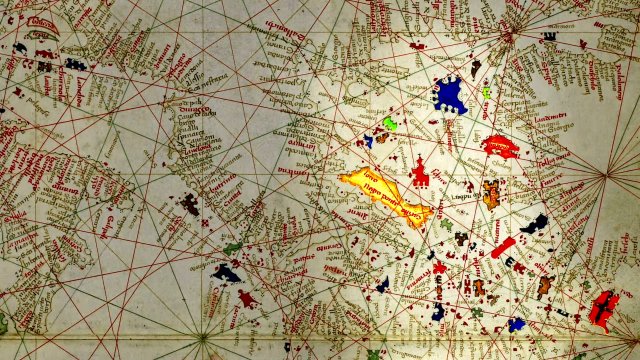
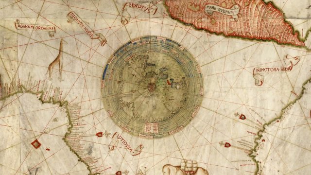
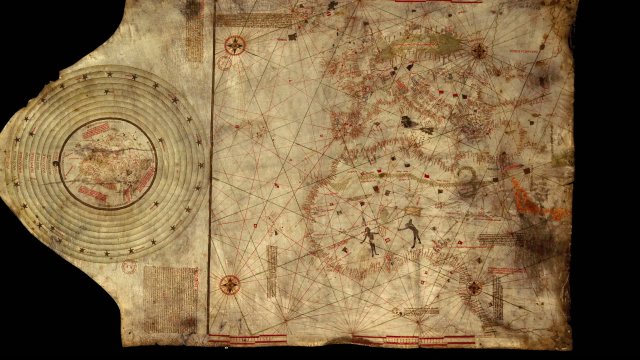
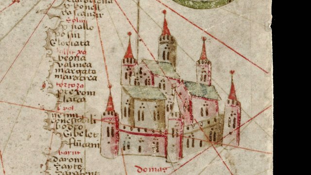
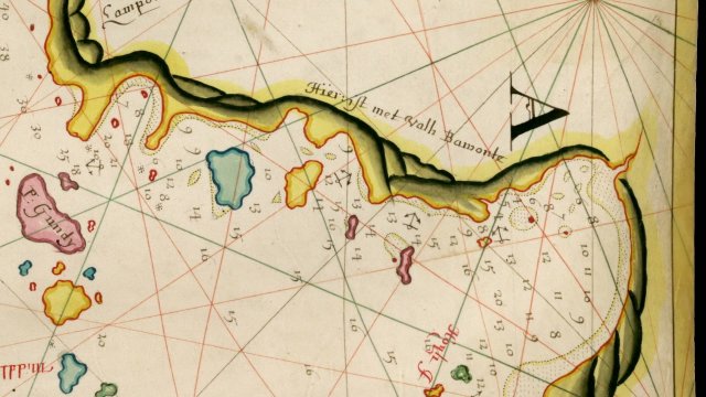
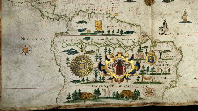
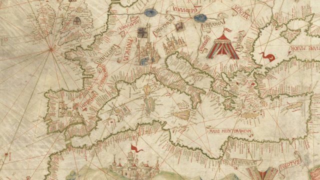
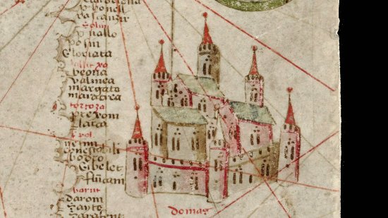
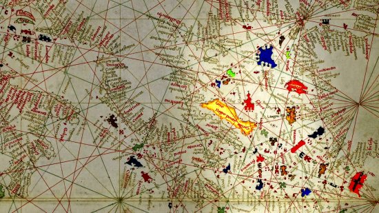
At the Heat of the MapsThis ornamental nautical chart, also called portolan, dated 1662, was produced by François Ollive's workshop in Marseilles. Enclosed in a trompe l'oeil frame and illustrated with numerous coats of arms, city views, naval battle scenes, sea monsters and sirens, it was not intended for use at sea, but to serve as a ceremonial document for wealthy merchants. Numerous ornaments on the southern shores of the Mediterranean highlighted the geopolitical and commercial importance of this region for Marseilles seaport.
A map kept at the French national library BnF (Bibliothèque nationale de France), Maps and Plans Department, shelf mark number GE A 850 RES
View this document in the digital Gallica library:
https://gallica.bnf.fr/ark:/12148/btv1b5906266z
Duration
00:04:48
Production year
Définition
HD
Color
Color
Sound
Sound
Version(s)
French
Original material
HD
Add to my selection
Terms of use
The use of media visible on the CNRS Images Platform can be granted on request. Any reproduction or representation is forbidden without prior authorization from CNRS Images (except for resources under Creative Commons license).
No modification of an image may be made without the prior consent of CNRS Images.
No use of an image for advertising purposes or distribution to a third party may be made without the prior agreement of CNRS Images.
For more information, please consult our general conditions