Scientific news

European Heritage on the move

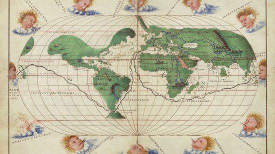
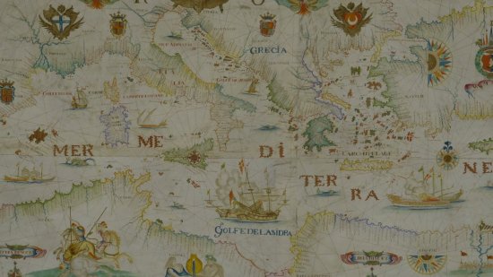
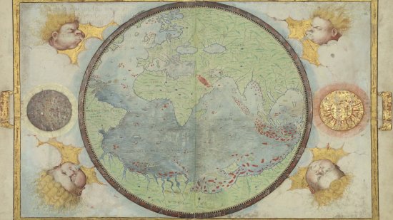
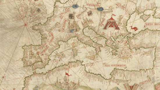
Devoted this year to the heritage of routes, networks and the sea, the European Heritage Days are an invitation to explore. It's an opportunity to celebrate the region, but above all its maps.

Mount Etna, Sicily © Sonia COLLAVIZZA / Geo-Ocean / CNRS Images
Mount Etna, Sicily

© Sonia COLLAVIZZA / Geo-Ocean / CNRS Images

View the media

Created in 1984 as ‘Open Days of Historical Monuments’ by the French Ministry of Culture, the European Heritage Days aim to show the extraordinary wealth of our heritage through original events, unusual visits and exceptional openings.

The European Heritage Days will be held on Saturday 21 and Sunday 22 September 2024, throughout France. They are based around the themes of ‘Heritage of routes, networks and connections’ and ‘Maritime heritage’, which is all about exploration, travel and leaping into the unknown.

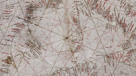
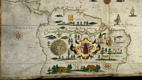
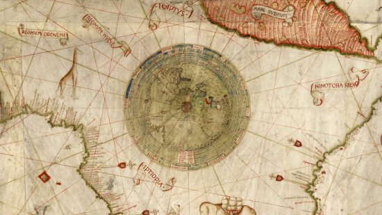
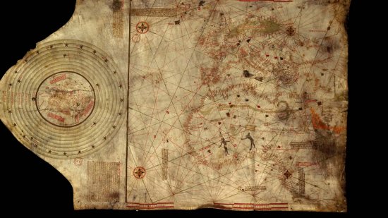
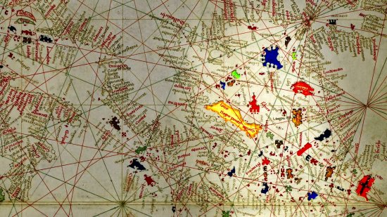
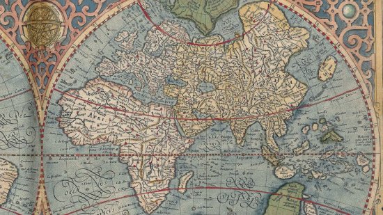
So follow us off the beaten track, and wander around our map of maps, from report to report!

Open media modal

Only available for non-commercial distribution

This nautical chart of the Indian Ocean covers the entire expanse of the Dutch East India Company's operations from the Cape of Good Hope to Japan. It was engraved on copper and printed on vellum in Amsterdam by Pieter Goos (1616-1675) in 1660, then republished in 1700 by Johannes Van Keulen. This portolan depicted the state of Dutch knowledge about the Indian Ocean and the southwest Pacific in 1644 after the exploratory sailing of the Dutchman Abel Tasman along the coast of Australia. A unique…

Video
6879
Map of the East Indies, from the Cape of Good Hope to Japan by Pieter Goos, 1700
Open media modal

Only available for non-commercial distribution

This portolan map of the Mediterranean and Black Sea was drawn on a single velum leaf. The date, 1447, and the signature of the artist, Gabriel de Vallseca, are located on the neck of the animal which provided its skin. Vallseca was a representative of the Catalan cartographic school that produced many ornamental nautical charts from the 14th century onwards. The area depicted is closed around the Mediterranean. The coastline is finely drawn from Gibraltar to Syria, and nine cities from the…

Video
6874
Nautical chart of the Mediterranean and Black Sea by Gabriel de Vallseca - 1447
Open media modal

Only available for non-commercial distribution

Les Atlas sociaux numériques, conçus et produits en accès ouvert au sein du laboratoire Espaces et société (ESO), proposent une traversée dans les sociétés de cinq villes de l'ouest de la France (Nantes, Caen, Angers, Le Mans et Rennes), à travers l'art urbain, les niveaux de revenus ou le dynamisme associatif. Fondés sur une démarche interdisciplinaire en sciences humaines et sociales, ces travaux mobilisent les savoir-faire et les domaines d'expertise des sciences de l'information…

Video
7798
Cristal collectif 2023 : Atlas sociaux et valorisation numérique de la recherche
Open media modal

Only available for non-commercial distribution

The Catalan Atlas is a collection of illuminated charts bound together like a book. Intended for the King of France, it gave him a picture of the entire known world in his time. Geographical, political and economic details are intermingled with ancient legends and the "wonders” of distant Asia on these portolan maps. These are based on medieval tales, like the Books of Marvels of the World based on Marco Polo's travels. A map kept at the French national library BnF (Bibliothèque nationale…

Video
6862
The Catalan Atlas by Abraham Cresques - 14th century
Open media modal

Only available for non-commercial distribution

This gilded ceremonial nautical chart which was drawn in 1622 in the manner of a painting is the work of Hessel Gerritsz, who was the chief hydrographer of the Dutch East India Company from 1617 to 1632. This is the first depiction of the Pacific Ocean in its whole as it was then sailed through by Dutch ships. The author of this portolan included portraits of the Pacific discoverers, Balboa, Magellan and Le Maire. He thus paid tribute to the navigators while asserting Holland's claim to…

Video
6865
Map of the Atlantic Ocean by Hessel Gerritsz, 1622
Open media modal

Only available for non-commercial distribution

This beautifully designed portolan atlas made in Venice is generally ascribed to Battista Agnese and dated to the 1540s. It charts the entire world then explored by Europeans with Europe, Asia, Africa, and much of the Americas, as well as the routes of the great Portuguese and Spanish explorers. Battista Agnese's atlas is a celebration of the European explorations of the world as viewed from Venice. A map kept at the French national library BnF (Bibliothèque nationale de France),…

Video
6864
Nautical Atlas of the World by Battista Agnese, circa 1540-1550
Open media modal

Only available for non-commercial distribution

This ornamental nautical chart, also called portolan, dated 1662, was produced by François Ollive's workshop in Marseilles. Enclosed in a trompe l'oeil frame and illustrated with numerous coats of arms, city views, naval battle scenes, sea monsters and sirens, it was not intended for use at sea, but to serve as a ceremonial document for wealthy merchants. Numerous ornaments on the southern shores of the Mediterranean highlighted the geopolitical and commercial importance of this region for…

Video
6870
Map of the Atlantic Ocean by François Ollive, 1662
Open media modal

Only available for non-commercial distribution

Portrait de Jean Nabucet, médaille de cristal du CNRS 2023, ingénieur de recherche en sciences de l'information géographique au laboratoire Littoral, environnement, télédétection, géomatique. Jean Nabucet est en constante recherche de nouveaux outils à déployer ou à développer pour l'observation de la Terre. Géographe spécialiste de l'évaluation de l'impact des sociétés humaines sur le paysage urbain par télédétection, il obtient son doctorat de géographie en 2018. Au quotidien,…

Video
7799
Médaille de Cristal 2023 : Jean Nabucet, ingénieur de recherche en sciences de l'information géographique
Open media modal

Only available for non-commercial distribution

The Miller Atlas, named after its former owner, is a collection of nautical charts completed in 1519. Commissioned by the King of Portugal Manuel I, it is a masterpiece of Portuguese cartography resulting from the collaboration of several cartographers and artists: Lopo Homem, Pedro Reinel, Jorge Reinel and the illuminator Antonio de Holanda. It was intended to show the power and expanse of the Portuguese Empire, which extended from Brazil to Indonesia. This portolan opens onto a world map…

Video
6866
Nautical Atlas of the World, aka Atlas Miller by Lopo Homen, Pedro Reinel, Jorge Reinel and Antonio de Holanda, 1519
Open media modal

Only available for non-commercial distribution

This map was drawn up by the Genoese Nicolas Caverio circa 1505 and shows all the Portuguese ports of call along the route to the Indies. It provided one of the oldest mappings of the east coast of Africa. The Indian Ocean which had been explored as early as 1498 by Vasco de Gama was gradually taking its modern form. This famous portolan is also a record of European explorations in Central America and Brazil at the turn of the 16th century. A map kept at the French national library BnF …

Video
6868
Nautical word map by Nicolas Caverio, 1506
Open media modal

Only available for non-commercial distribution

Dated from the late13th century, the so-called "Pisana Carta” is considered to be the oldest nautical chart that has ever come down to us. It mainly covers the Mediterranean Sea, of which the Spanish and French coasts and the large islands are represented with some degree of accuracy. This map is part of the charts called "portolans” and it comprises their main attributes: harbour and port names inscribed perpendicular to the coastline, wind lines indicating compass directions and distance…

Video
6873
Pisana Carta, Anonymous - 13th century (The)
Open media modal

Only available for non-commercial distribution

The author of this 1699 nautical chart, John Thornton, served with two English trading companies. The Island of Sumatra, the Straits of Malacca and the Sunda which are shown here were strategic passages to Southeast Asia and the Spice Islands. The style of this portolan, its harmony of colours and careful handwriting are the essential characteristics of the works of this English cartographer. A map kept at the French national library BnF (Bibliothèque nationale de France), Maps and Plans…

Video
6872
Map of the Sunda Strait by John Thornton, 1699
Open media modal

Only available for non-commercial distribution

First of all, this map shows the extent of the knowledge Norman cartographers had gained about America, especially in Acadia and Brazil. A juxtaposition of French and Spanish coats of arms seems to express a joint domination over the fabulous riches of the New Worlds. This portolan is less a navigational tool than a political document. A map kept at the French national library BnF (Bibliothèque nationale de France), Maps and Plans Department, shelf mark number GE SH ARCH-6 View this…

Video
6871
Map of the Atlantic Ocean by Pierre de Vaulx - 1613
Open media modal

Only available for non-commercial distribution

This nautical planisphere was made in 1573 by Domingos Teixeira, a member of a prominent lineage of Portuguese cartographers. It represents the extent of European knowledge after a century and a half of exploratory voyages. Only Oceania and the confines of Asia and America remained unknown. This portolan bore a strong geopolitical significance because it depicts the meridian and anti-meridian defined by the Treaty of Tordesillas in 1494 which drew a demarcation line between the areas of…

Video
6878
Planisphere by Domingos Teixeira - 1573
Open media modal

Only available for non-commercial distribution

This 15th century anonymous nautical chart could not be accurately dated. Charles de La Roncière ascribed it to Christopher Columbus in 1924. This portolan is divided into two parts by a line enhanced with gold and which represent two distinct spaces. The right-hand side is a nautical chart of the Mediterranean and includes Portuguese discoveries in Africa extending as far as the Gulf of Guinea, and also speculative territories in the North Atlantic Ocean. A small world map is depicted on the…

Video
6877
Nautical chart of the North-East Atlantic, the Baltic Sea, the Mediterranean Sea and the Black Sea by Christopher…
Open media modal

Only available for non-commercial distribution

The author of this atlas was a former ship captain and produced a large number of atlases and maps in Venice and Rome in the second half of the 15th century. These maps show the Mediterranean Sea and the Black Sea, and also the coasts and islands of the Atlantic Ocean from England to the shores of Africa which the Portuguese had recently explored. A map kept at the French national library BnF (Bibliothèque nationale de France), Maps and Plans Department, shelf mark number GE DD-1988…

Video
6888
Nautical Atlas of the North-East Atlantic Ocean, the Mediterranean Sea and the Black Sea by Grazioso Benincasa, 1467
Open media modal

What do we know about the Indian Ocean? It was not the result of an extraordinary discovery but rather of successive explorations and exchanges between the civilizations of the West and the East. Historians trace the history of its representation through the study of nautical charts from Antiquity to the 18th century. They thus show us that the narrative of its fabrication is strongly linked to its representation and that the maps have thus contributed to giving this ocean its meaning and…

Video
6630
How the Indian Ocean was invented

CNRS Images,

Our work is guided by the way scientists question the world around them and we translate their research into images to help people to understand the world better and to awaken their curiosity and wonderment.