Research program(s)
Production year
2005

© Patrick WASSMER/LGP/CNRS Images
20140001_2270
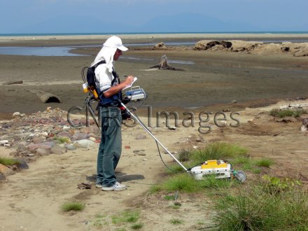
Auscultation du sol par géoradar ou radar au sol, après le tsunami du 26 décembre 2004 à Banda Aceh, en Indonésie. Les chercheurs ont ainsi mesuré l'épaisseur et cartographié les dépôts sableux transportés par le tsunami. Ces mesures ont été réalisées dans le cadre du programme Tsunarisque mené en 2005-2006, pour mieux comprendre ce phénomène et mettre en place une meilleure prévention. Le géoradar permet d'ausculter le sous-sol de façon non-destructive et rapide, par la transmission d'ondes électromagnétiques.
The use of media visible on the CNRS Images Platform can be granted on request. Any reproduction or representation is forbidden without prior authorization from CNRS Images (except for resources under Creative Commons license).
No modification of an image may be made without the prior consent of CNRS Images.
No use of an image for advertising purposes or distribution to a third party may be made without the prior agreement of CNRS Images.
For more information, please consult our general conditions
2005
Our work is guided by the way scientists question the world around them and we translate their research into images to help people to understand the world better and to awaken their curiosity and wonderment.