Production year
2019

© Jean-François RITZ / Géosciences Montpellier / CNRS Images
20200011_0001
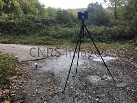
Cartographie de plis et fissures en échelons affectant une route, à l'aide d'un scanner laser terrestre. Il s'agit d'un indice de rupture de surface associé à un séisme de magnitude 5 qui s'est produit le 11 novembre 2019 aux environs du Teil, en Ardèche. Cette image a été réalisée dans le cadre du rapport d'un comité d’experts formé par le CNRS afin d’étudier ce phénomène et ses origines.
The use of media visible on the CNRS Images Platform can be granted on request. Any reproduction or representation is forbidden without prior authorization from CNRS Images (except for resources under Creative Commons license).
No modification of an image may be made without the prior consent of CNRS Images.
No use of an image for advertising purposes or distribution to a third party may be made without the prior agreement of CNRS Images.
For more information, please consult our general conditions
2019
Our work is guided by the way scientists question the world around them and we translate their research into images to help people to understand the world better and to awaken their curiosity and wonderment.