Research program(s)
Production year
2016

© Bruno JOURDAIN / IGE / CNRS Images
20170034_0016
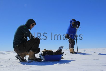
Initial measurements of albedo, the ratio of reflected solar energy to incident energy, performed during the ASUMA (Improving the Accuracy of the SUrface Mass balance of Antarctica) expedition on the continent of Antarctica. ASUMA is an ANR/IPEV programme under whose auspices a scientific expedition left point D10, a few kilometres from the French Dumont d’Urville base in Antarctica, on 1 December 2016, heading towards the centre of the continent. The goal of this programme is in particular to better understand the current evolution of the snow accumulated on the surface of Antarctica from one year to the next. This would make it possible to reduce uncertainty regarding its current regimen and its possible impact on sea levels. The ASUMA expedition took place in an area still largely unknown from a scientific point of view, because very few measurements have been made on the ground. It is a transition zone between the coast and the Antarctic Plateau.
The use of media visible on the CNRS Images Platform can be granted on request. Any reproduction or representation is forbidden without prior authorization from CNRS Images (except for resources under Creative Commons license).
No modification of an image may be made without the prior consent of CNRS Images.
No use of an image for advertising purposes or distribution to a third party may be made without the prior agreement of CNRS Images.
For more information, please consult our general conditions
2016
Our work is guided by the way scientists question the world around them and we translate their research into images to help people to understand the world better and to awaken their curiosity and wonderment.