Production year
2012

© Adeline MAULPOIX/CNRS Images
20130001_1225
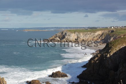
Vue sur la mer d'Iroise prise près de la pointe de Corsen, sur la commune de Plouarzel, dans le Finistère. Le périmètre de la Zone atelier Brest Iroise (ZABrI) correspond à l'emprise maritime du Parc naturel marin d'Iroise, soit 3 550 km² du nord de l'île d'Ouessant au sud de l'île de Sein. Au large, sa limite correspond à la limite des eaux territoriales (12 milles marins). La ZABrI ambitionne d'améliorer les connaissances du fonctionnement et de l'évolution du socio-écosystème côtier, dans un contexte de changements et dans une perspective de gestion intégrée.
The use of media visible on the CNRS Images Platform can be granted on request. Any reproduction or representation is forbidden without prior authorization from CNRS Images (except for resources under Creative Commons license).
No modification of an image may be made without the prior consent of CNRS Images.
No use of an image for advertising purposes or distribution to a third party may be made without the prior agreement of CNRS Images.
For more information, please consult our general conditions
2012
Our work is guided by the way scientists question the world around them and we translate their research into images to help people to understand the world better and to awaken their curiosity and wonderment.