Production year
2012

© Thibaut VERGOZ/CNRS Images
20130001_0613
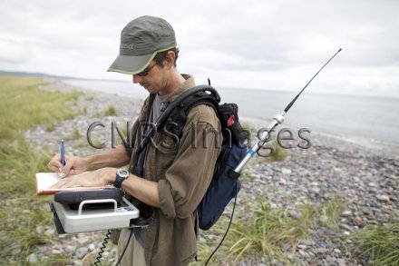
Scientifique du WHOI (Woods hole oceanographic institution) effectuant des levés géophysiques de l'isthme Miquelon-Langlade, le long de transects transversaux est-ouest. Cet isthme est un cordon littoral sableux reliant les deux presqu'îles de Grande Miquelon et Langlade, dans l'archipel de Saint-Pierre-et-Miquelon. Un système géoradar (radar à pénétration de sol) enregistre et affiche en temps réel le profil du sous-sol. Trois antennes de fréquences différentes enregistrent chacune à une profondeur et une résolution spécifique. Cela permet d'obtenir une coupe du sous-sol jusqu'à 15 m de profondeur, avec différents niveaux de zoom et de précision. L'objectif est de comprendre l'architecture interne de l'isthme, afin de remonter aux grandes étapes de sa formation.
The use of media visible on the CNRS Images Platform can be granted on request. Any reproduction or representation is forbidden without prior authorization from CNRS Images (except for resources under Creative Commons license).
No modification of an image may be made without the prior consent of CNRS Images.
No use of an image for advertising purposes or distribution to a third party may be made without the prior agreement of CNRS Images.
For more information, please consult our general conditions
2012
Our work is guided by the way scientists question the world around them and we translate their research into images to help people to understand the world better and to awaken their curiosity and wonderment.