Production year
2016

© Erwan AMICE / LEMAR / CNRS Images
20180012_0021
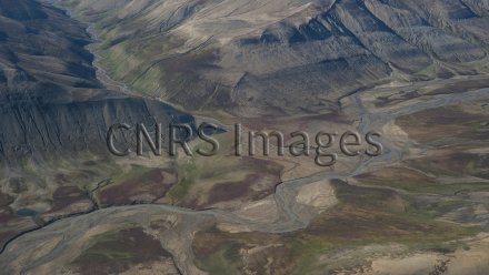
Cours d’eau au sud-est du Groenland, à proximité de l’aérodrome de Constable Point. La fonte des neiges et des glaciers crée un réseau de cours d’eau et de lacs intérieurs. L’érosion de la roche provoquée par ce phénomène transforme le paysage estival du pays. Des lichens, des mousses et d’autres plantes se développent à la même époque et donnent aux paysages du Groenland ces teintes vertes et jaunes lui ayant valu son nom, qui signifie la terre verte. Cette image a été réalisée dans le cadre du projet PRIVARC.
The use of media visible on the CNRS Images Platform can be granted on request. Any reproduction or representation is forbidden without prior authorization from CNRS Images (except for resources under Creative Commons license).
No modification of an image may be made without the prior consent of CNRS Images.
No use of an image for advertising purposes or distribution to a third party may be made without the prior agreement of CNRS Images.
For more information, please consult our general conditions
2016
Our work is guided by the way scientists question the world around them and we translate their research into images to help people to understand the world better and to awaken their curiosity and wonderment.