Research program(s)
Production year
2015

© Thibaut VERGOZ/IPEV/LGGE/CNRS Images
20150001_0873
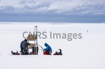
Vérification du bon fonctionnement d'une station d'enregistrement GPS sur le glacier "école" de l'Astrolabe, près de la base Dumont d'Urville en Terre-Adélie, Antarctique. Cette station vient d'être réinstallée après un hiver sans intervention dessus. Depuis 2011, neuf stations GPS enregistrent en continu les mouvements de ce glacier en trois dimensions. Ces stations sont autonomes en énergie grâce à des panneaux solaires et des batteries. L'Astrolabe progresse de 450 m par an, soit plus d'un mètre par jour, et jusqu'à près de 600 m par an dans sa partie la plus rapide. Cette mission a été menée dans le cadre du programme DACOTA dont l'objectif est de comprendre la dynamique de l'écoulement du glacier.
The use of media visible on the CNRS Images Platform can be granted on request. Any reproduction or representation is forbidden without prior authorization from CNRS Images (except for resources under Creative Commons license).
No modification of an image may be made without the prior consent of CNRS Images.
No use of an image for advertising purposes or distribution to a third party may be made without the prior agreement of CNRS Images.
For more information, please consult our general conditions
2015
Our work is guided by the way scientists question the world around them and we translate their research into images to help people to understand the world better and to awaken their curiosity and wonderment.