Production year
1989

© Stephen ROSTAIN/ARCHAM/CNRS Images
20100001_0621
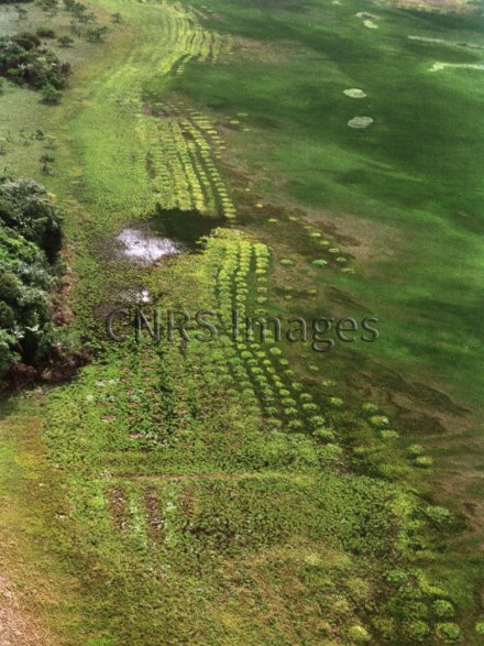
Champs surélevés sur le territoire du Centre Spatial Guyanais. Les savanes côtières guyanaises sont émaillées de petites buttes. Des chercheurs viennent de découvrir que ces vestiges d'un système agricole précolombien ont été construits il y a près de 900 ans. Ils ont aussi mis en évidence que ces îlots bien drainés dans un milieu saisonnièrement inondé ont été investis par d'autres organismes (animaux et plantes) qui maintiennent encore aujourd'hui l'édifice en relief. Cet exemple de paysage modelé par l'homme puis entretenu par la nature pourrait servir à imaginer des systèmes d'agriculture "écologiquement" intensifs.
The use of media visible on the CNRS Images Platform can be granted on request. Any reproduction or representation is forbidden without prior authorization from CNRS Images (except for resources under Creative Commons license).
No modification of an image may be made without the prior consent of CNRS Images.
No use of an image for advertising purposes or distribution to a third party may be made without the prior agreement of CNRS Images.
For more information, please consult our general conditions
1989
Our work is guided by the way scientists question the world around them and we translate their research into images to help people to understand the world better and to awaken their curiosity and wonderment.