Production year
2004

© Jérôme FOURNIER/CNRS Images
20050001_1843
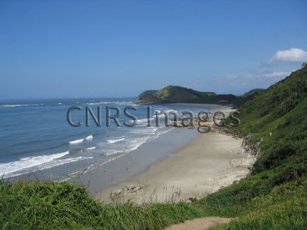
Plages orientales de l'Ilha do Mel, située au milieu de l'embouchure du complexe estuarien de Paranaguá (état du Paraná, Brésil). Cette baie est étudiée pour la caractérisation et l'évolution spatio-temporelle des phytocénoses (communautés végétales) littorales. Elle se situe à une limite biogéographique très marquée de l'Amérique du Sud (côte Atlantique), elle sépare le domaine tropical du domaine sub-tropical, et elle abrite des espèces et des formations végétales des deux domaines. Un éventuel changement climatique de grande ampleur se traduirait par l'extension ou la régression de la végétation appartenant à un des deux domaines.
The use of media visible on the CNRS Images Platform can be granted on request. Any reproduction or representation is forbidden without prior authorization from CNRS Images (except for resources under Creative Commons license).
No modification of an image may be made without the prior consent of CNRS Images.
No use of an image for advertising purposes or distribution to a third party may be made without the prior agreement of CNRS Images.
For more information, please consult our general conditions
2004
Our work is guided by the way scientists question the world around them and we translate their research into images to help people to understand the world better and to awaken their curiosity and wonderment.