Research program(s)
Production year
2019

© Jean-Pierre TOUMAZET / GEOLAB / CNRS Images
20190063_0003
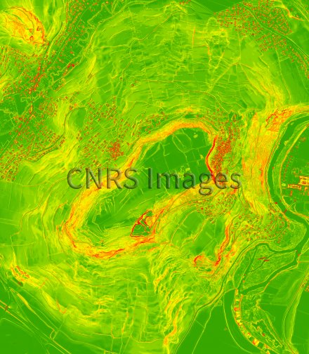
Si vous survolez l’oppidum de Corent aujourd’hui, dans le Puy-de-Dôme, ce n’est pas tout à fait ce que vous pourrez y voir. Ceci est l’environnement d’une agglomération gauloise de 10 km² reconstruit numériquement. Grâce à une nouvelle technique en cours d’optimisation, le relevé topographique par LiDAR aéroporté, les chercheurs sont parvenus à supprimer la végétation et effacer le relief naturel, mettant ainsi à découvert ces vestiges remontant pour certains à l’époque gauloise : en rouge, on distingue les éléments en surélévation comme le bâti ou les terrasses, en vert, ceux en creux. De quoi mieux orienter de futures fouilles archéologiques. Cette image a été lauréate du concours La preuve par l’image (LPPI) 2019.
The use of media visible on the CNRS Images Platform can be granted on request. Any reproduction or representation is forbidden without prior authorization from CNRS Images (except for resources under Creative Commons license).
No modification of an image may be made without the prior consent of CNRS Images.
No use of an image for advertising purposes or distribution to a third party may be made without the prior agreement of CNRS Images.
For more information, please consult our general conditions
2019
Our work is guided by the way scientists question the world around them and we translate their research into images to help people to understand the world better and to awaken their curiosity and wonderment.